Hirdetés
3D, the big hit
Yes, YES! The world has ceased to be a 2 dimensional place, iGO 8 is not only a spaghetti of stripes running around, but a world easily recognizable by us, showing buildings, or at least contours of them, we can see by looking out of the car. Of course not always and not everywhere. When in downtown, passing trough narrow streets, buildings get faint – just like Melvin in Jeff Dunham’s show, even though he looks at boobs with his X-ray vision instead of buildings. Of course the picture is far from being completely realistic, but it’s more than enough to make locations recognizable.
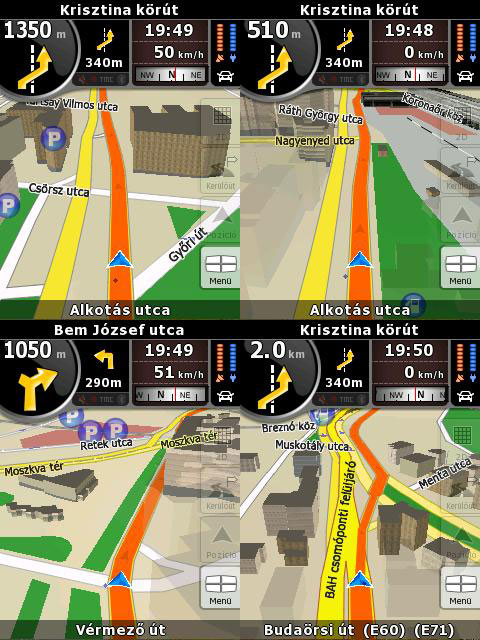
Not only houses are displayed, but any object that is large enough to be characteristic of a given place. Even more, flyovers have a shadow, but if this is still not enough: iGO8 switches to night mode when passing through a tunnel, thus avoiding the light of the navi blinding us. Of course it doesn’t do it with light sensors. It knows where tunnels are. It’s simple but effective and shows very well that the designers have thought of small details too.
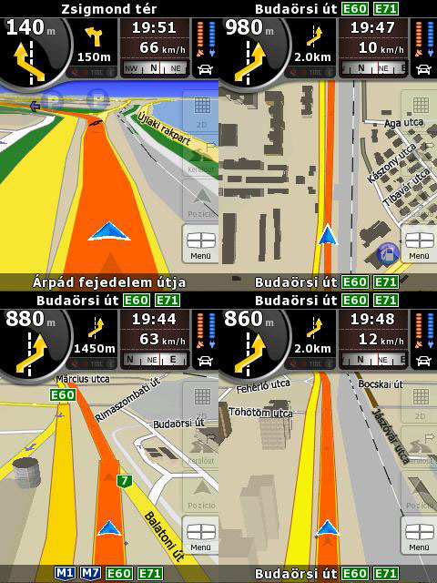
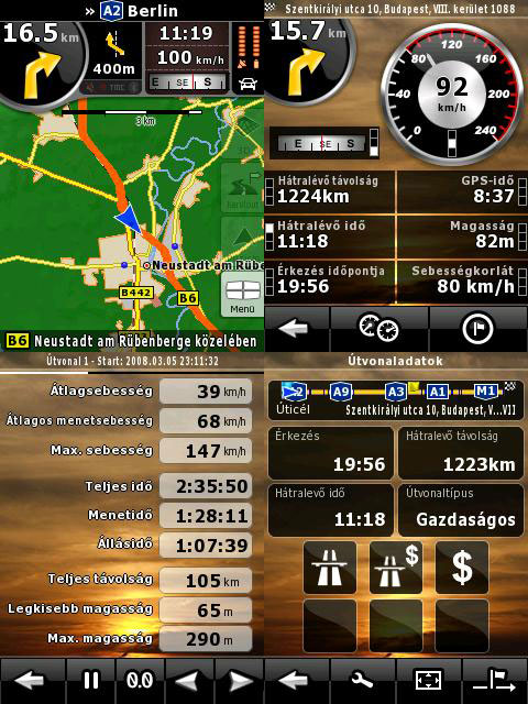
Buildings are present everywhere where there is some kind of sizable civilization and they get more and more detailed as we are closing up to a city center. Unfortunately, contrary to the gossip, the software won’t read out street names, this might be available in the next version. Of course the map has relief data too, besides the standard view from above and 3D, just like in the world atlas. iGO8 is “ONS-compatible”. It can collect, organize and display such an amount of data of our trip, that no experienced statistician will ever take a look at the yearbook again if he can take a hold of such an application. It measures our speed, average speed, greatest speed, travel time, standing time, lowest and highest position and of course distance too. Shocking, isn’t it?
A cikk még nem ért véget, kérlek, lapozz!


